
Every bridge standing across the River Tyne is the survivor of a long and often difficult planning process. Funding had to be found, engineers had to prove their designs could work and politicians on both sides of the river had to agree that construction was worth the disruption and expense.
Far less visible are the proposals that failed.
Newcastle and Gateshead could have been connected by several additional railway, road and pedestrian crossings. Plans included a Victorian railway bridge at St Anthony’s, a major road crossing at Pelaw and a motorway bridge beside the present Tyne Bridge. Some were discussed repeatedly over several decades. Others progressed far enough for connecting roads to be constructed before the central bridge itself was abandoned.
These forgotten Tyne bridge plans reveal that Newcastle’s familiar skyline was not inevitable. It is the result of choices made between competing visions of how the city should grow.
St Anthony’s attracted plans for almost a century.
One of the most frequently proposed crossing points was St Anthony’s, east of Newcastle city centre.
Historical bridge records list proposed railway crossings at St Anthony’s in 1836, 1848, 1893 and 1918. Road bridges were also suggested there in 1920, 1925 and again in 1992. None reached construction.
The repeated interest was understandable. A bridge in this part of the Tyne could have created a useful connection between eastern Newcastle and communities on the Gateshead side while allowing traffic to avoid the increasingly congested city-centre crossings.
The dates also show that St Anthony’s was not a single unsuccessful idea. It was a location to which planners repeatedly returned as Newcastle expanded and transport demands changed.
The earliest schemes emerged during the rapid growth of the railway age. By the twentieth century, attention had shifted towards road traffic. The proposal therefore survived in different forms because each generation saw the same basic opportunity, even if it imagined a different type of bridge.
Its failure to advance may have resulted from cost, difficult approach routes and competition from other infrastructure priorities. Whatever the precise reasons behind each scheme, the repeated proposals demonstrate how seriously eastern crossings were considered.
Pelaw Bridge competed for political support.
By the early 1920s, congestion around the Swing Bridge had become a pressing problem.
Traffic crossing between Newcastle and Gateshead had to descend steep streets towards river level. The Swing Bridge also had to open for shipping, interrupting road journeys whenever vessels passed through.
In 1923, a joint body representing Tyneside planning authorities considered four possible solutions consisting of three bridges and a tunnel. Newcastle reportedly favoured a Pelaw Bridge approximately two miles downstream from the city centre.
A Pelaw crossing would have addressed a broader regional transport problem rather than simply creating another city-centre landmark. It could have redirected through traffic away from central Newcastle and provided a new connection between communities farther east.
However, the central high-level crossing ultimately won.
Civil engineer T M Webster had proposed a high-level road bridge aligned with the Great North Road in 1921. Newcastle and Gateshead corporations agreed to that approach in 1924, clearing the way for the bridge now recognised around the world as the Tyne Bridge.
The decision left Pelaw Bridge as one of the most significant roads not taken in Newcastle transport history. Had it been selected, traffic patterns across eastern Tyneside might have developed very differently.
A motorway bridge nearly transformed the Quayside.
The most dramatic unbuilt crossing emerged from Newcastle’s post-war enthusiasm for urban motorways.
During the early 1960s, planners proposed a network of high-capacity roads around central Newcastle. The system was intended to remove through traffic from shopping streets and connect major routes on both sides of the Tyne. The Central Motorway East, now the A167(M), was only one part of that much larger vision.
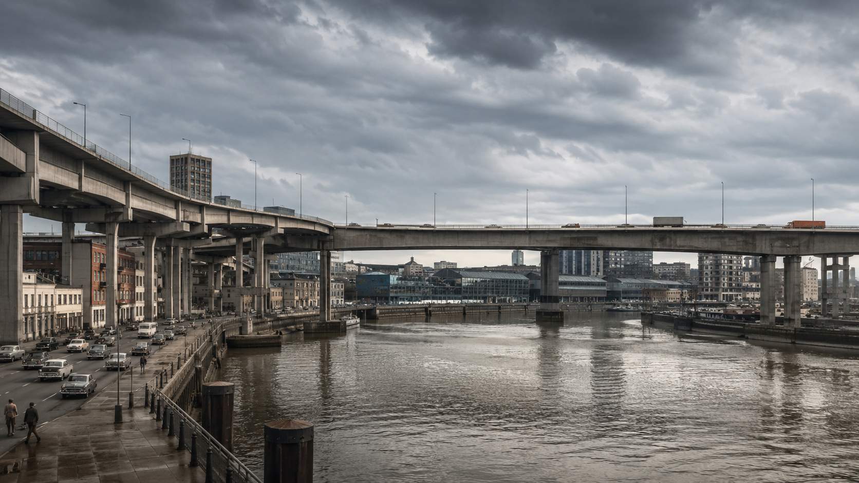
At the heart of the scheme was a new motorway-grade bridge immediately east of the Tyne Bridge.
It would have linked Newcastle’s Central Motorway with the Gateshead Viaduct, crossing the river close to the site now occupied by The Glasshouse International Centre for Music. The proposed structure would have placed another large road crossing within one of the Tyne’s most celebrated views.
Unlike many abandoned bridge concepts, this proposal left physical evidence behind.
Unused road spurs were built into Newcastle’s motorway system in anticipation of the crossing. Corresponding connections were also prepared on the Gateshead side. The bridge was cancelled, but sections of road designed to feed it remained, creating visible turn-offs that led nowhere.
These fragments make the motorway bridge particularly fascinating. They show that the project was more than a speculative sketch. Parts of the surrounding road network were designed around the expectation that a new Tyne crossing would eventually complete the route.
Why the motorway crossing was abandoned.
The bridge belonged to an era when planners expected private cars and urban motorways to dominate the future of British cities.
That confidence weakened as the social and architectural cost of large road schemes became clearer. Urban motorway projects required extensive demolition, divided established neighbourhoods and often encouraged further traffic growth rather than permanently solving congestion.
Newcastle’s planned network was never completed in full, leaving the Central Motorway as a surviving section of a much more ambitious system.
Abandoning the eastern bridge also prevented an enormous structure from competing visually with the Tyne Bridge, Quayside and Gateshead’s later cultural developments. The area where motorway traffic might have thundered across the river instead became central to the regeneration of Gateshead Quays.
The Baltic Centre for Contemporary Art and The Glasshouse now define that section of the south bank. It is difficult to imagine the same cultural landscape developing beneath the approaches to a major elevated motorway.
Railway planners considered other Tyne routes.
Road planners were not alone in examining alternative crossings.
By the end of the nineteenth century, the High Level Bridge was handling roughly 800 train and light-engine movements each day. The North Eastern Railway considered several responses, including widening the existing bridge to six tracks, constructing a bridge between Dunston and Elswick, and establishing another route between Heaton and Pelaw.
The company eventually selected a new crossing west of the High Level Bridge. This became the King Edward VII Bridge, which opened to general railway traffic in 1906.
The abandoned alternatives are important because they show that railway geography around Newcastle Central Station could have developed along another course. A Dunston to Elswick crossing would have shifted infrastructure farther west, while a Heaton to Pelaw route would have created a markedly different eastern rail connection.
Even the bridge that was built changed during development. Its original two-span design had to be reconsidered after abandoned coal workings were discovered near the intended approaches. The final structure used four main river spans supported by substantial piers.
Newcastle’s underground industrial history therefore influenced not only where bridges could be placed, but how surviving structures had to be engineered.
More than 150 modern designs were rejected.
Not every forgotten bridge proposal involved cars or trains.
In 1996, Gateshead Council launched an international competition for a pedestrian and cycle bridge linking Newcastle Quayside with the developing Gateshead cultural quarter. More than 150 entries were submitted, meaning over 149 concepts ultimately remained unbuilt.
A shortlist of six leading teams was presented, and Gateshead residents were invited to vote for their preferred design. The winning proposal by WilkinsonEyre and Gifford became the Gateshead Millennium Bridge.
Its tilting mechanism allowed the river to remain open to vessels while giving pedestrians and cyclists a low-level crossing. The bridge opened to the public in September 2001 and was formally inaugurated in May 2002.
The rejected competition entries offer a more recent version of the same hidden history. Newcastle and Gateshead could have received a lifting bridge, a swinging bridge or another visually dramatic structure. Instead, the tilting design became part of the modern identity of the Quayside.
The scale of Tyne traffic explains the ambition.
The pressure that inspired earlier proposals has not disappeared.
The Tyne Bridge alone can carry up to 70,000 vehicles on a busy day, according to Newcastle City Council. Its importance became especially clear when restoration work reduced the four-lane crossing to one lane in each direction.
The current restoration programme is expected to run until summer 2028, when the bridge will celebrate the centenary of its October 1928 opening.
Those figures help explain why planners repeatedly imagined additional crossings. A bridge is not simply a landmark. It determines where people live, how businesses receive goods and how quickly communities can reach jobs, schools and services.
Every unsuccessful proposal attempted to answer a real transport question, even when the suggested solution later became unaffordable, impractical or politically unacceptable.
Newcastle’s skyline was never guaranteed.
The bridges visible from Newcastle Quayside represent only a small selection from hundreds of possible designs and numerous proposed locations.
A Pelaw Bridge might have shifted road traffic east. A St Anthony’s crossing could have created a new development corridor. A Dunston to Elswick railway bridge might have altered the approach to Newcastle Central Station. The Central Motorway bridge would have permanently changed one of the most photographed views in the North East.
Their absence is part of Newcastle’s history.
Unbuilt infrastructure reveals what earlier generations feared, expected and valued. Victorian railway schemes reflected industrial expansion. The Pelaw proposal responded to city-centre congestion. The motorway crossing belonged to an age of car-led redevelopment, while the Millennium competition placed public space, cycling and architecture at the centre of the brief.
The River Tyne has always attracted ambitious ideas. Some became engineering landmarks. Others survive only in archive catalogues, abandoned approach roads and plans for a Newcastle that was imagined but never constructed.
Share your thoughts below.
Which of Newcastle’s lost Tyne bridges would have changed the city most dramatically?
Newcastle History
The 20 Missing Bridges of Newcastle and Gateshead That Never Got Built
Advertisement



Comments (0)
You must be logged in to post comments.
Don't have an account? Register here
No comments yet. Be the first to share your thoughts!